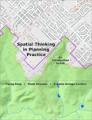
Spatial Thinking in Planning Practice: An Introduction to GIS
by Y. Fang, V. Shandas, E. Arriaga Cordero
Publisher: Portland State University 2014
ISBN-13: 9781312778986
Number of pages: 59
Description:
The goals of this textbook are to help students acquire the technical skills of using software and managing a database, and develop research skills of collecting data, analyzing information and presenting results. We emphasize that the need to investigate the potential and practicality of GIS technologies in a typical planning setting and evaluate its possible applications.
Download or read it online for free here:
Download link
(8.9MB, PDF)
Similar books
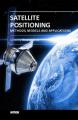 Satellite Positioning: Methods, Models and Applications
by Shuanggen Jin (ed.) - InTech
This book is devoted to recent development in satellite positioning technique and applications, including GNSS positioning methods, models, atmospheric sounding, and reflectometry as well as their applications in the atmosphere, land and oceans.
(7212 views)
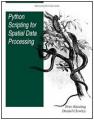 Python Scripting for Spatial Data Processing
by Pete Bunting, Daniel Clewley - Aberystwyth University
This book is a Python tutorial for beginners aiming at teaching spatial data processing. It is used as part of the courses taught in Remote Sensing and GIS at Aberystwyth University, UK. GIS belong the group of applications that process spatial data.
(8688 views)
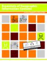 Essentials of Geographic Information Systems
by Jonathan Campbell, Michael Shin - Saylor Foundation
This book integrates key concepts behind the technology with practical concerns and real-world applications. Recognizing that many potential GIS users are non-specialists, the book is designed to be accessible, pragmatic and concise.
(11763 views)
 A Gentle Introduction to GIS
by T. Sutton, O. Dassau, M. Sutton
GIS is an important tool in environmental management, retail, military, police, tourism and many other spheres of our daily lives. If you use a computer or a cell phone, you have probably already used a GIS in some form without even realizing it.
(15170 views)