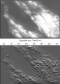
Image Estimation by Example: Geophysical Soundings Image Construction
by Jon Claerbout, Sergey Fomel
Publisher: Stanford University 2008
Number of pages: 330
Description:
This book is about the estimation and construction of geophysical images. Geophysical images are used to visualize petroleum and mineral resource prospects, subsurface water, contaminant transport (environmental pollution), archeology, lost treasure, even graves. People need more practice with easier problems like the ones found in this book, which are mostly simple 2-D landforms derived from 2-D data. Such concrete estimation problems are solved quickly, and their visual results provide experience in recognizing weaknesses, reformulating, and moving forward again.
Download or read it online for free here:
Download link
(9.5MB, PDF)
Similar books
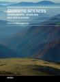 Geodetic Sciences: Observations, Modeling and Applications
by Shuanggen Jin - InTech
This presents recent results in space geodetic techniques and sciences, including GNSS, VLBI, gravimetry, geoid, geodetic atmosphere, geodetic geophysics and geodetic mass transport associated with the ocean, hydrology, cryosphere and solid-Earth.
(8409 views)
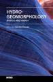 Hydro-Geomorphology: Models and Trends
by Dericks P. Shukla - InTech
The field of morphology of the Earth provides a basis for exploring, understanding and comprehending the forms and processes that occur in our surrounding. This book presents some of the ideas around the field of geomorphology ...
(5306 views)
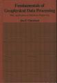 Fundamentals of Geophysical Data Processing
by Jon Claerbout - Blackwell Science Inc
The book about the use of computer programs for the analysis of geophysical data to try to determine the constitution of the Earth's interior, a process which enables a geophysicist to locate petroleum and mineral prospects.
(16620 views)
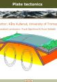 Plate Tectonics
by Kåre Kullerud - University of Michigan
Introductory flash-based, online book on plate tectonics - the movement of litosphere plates. Students using this book can see continents collide and watch what happens at the mid-ocean ridge. Fantastic full-color illustrations.
(15969 views)