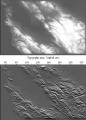
Image Estimation by Example: Geophysical Soundings Image Construction
by Jon Claerbout, Sergey Fomel
Publisher: Stanford University 2008
Number of pages: 330
Description:
This book is about the estimation and construction of geophysical images. Geophysical images are used to visualize petroleum and mineral resource prospects, subsurface water, contaminant transport (environmental pollution), archeology, lost treasure, even graves. People need more practice with easier problems like the ones found in this book, which are mostly simple 2-D landforms derived from 2-D data. Such concrete estimation problems are solved quickly, and their visual results provide experience in recognizing weaknesses, reformulating, and moving forward again.
Download or read it online for free here:
Download link
(9.5MB, PDF)
Similar books
 Why could ice ages be unpredictable?
by Michel Crucifix - arXiv
It is commonly accepted that the variations of Earth's orbit and obliquity control the timing of Pleistocene glacial-interglacial cycles. Evidence comes from analysis of palaeoclimate records. However, we do not know how tight this control is.
(6323 views)
 Engineering Seismology, Geotechnical and Structural Earthquake Engineering
by Sebastiano D'Amico (ed.) - InTech
The book deals with different topics aiming to mitigate geo-hazards: Seismic hazard analysis, Ground investigation for seismic design, assessment and remediation, Earthquake site response analysis and soil-structure interaction analysis.
(9000 views)
 Tectonics
by Damien Closson - InTech
The present book is restricted to the structure and evolution of the terrestrial lithosphere with dominant emphasis on the continents. Topics: Gondwana history, the tectonics of Europe and the Near East; the tectonics of Siberia; and more.
(11814 views)
 Probability and Statistics for Geophysical Processes
by D. Koutsoyiannis - National Technical University of Athens
Contents: The utility of probability; Basic concepts of probability; Elementary statistical concepts; Special concepts of probability theory in geophysical applications; Typical univariate statistical analysis in geophysical processes; etc.
(7463 views)