Geodesy for the Layman
by Richard K. Burkard
Publisher: Defense Mapping Agency 1984
Description:
The publication attempts to develop an appreciation of the scope of geodesy and to generate some understanding of the problems encountered in the science. The basic principles are presented through discussions of various geodetic topics such as: ellipsoids, geoid, horizontal surveying, leveling, geodetic datums and gravity.
Download or read it online for free here:
Read online
(online html)
Similar books
 Tectonics: Recent Advances
by Evgenii Sharkov (ed.) - InTech
This book is devoted to different aspects of modern geodynamic processes. The text covers up-to-date materials of detailed geological-geophysical investigations, which can help understand the essence of mechanisms of different tectonic processes.
(9912 views)
 Geochronology: Methods and Case Studies
by Nils-Axel Morner (ed.) - InTech
Chronology is the backbone of history, and there is a saying stating there is no history without a chronology. Earths evolutionary history is built up by geochronology, i.e. time benchmarks upon which the geological history is built up step by step.
(7339 views)
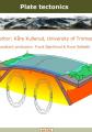 Plate Tectonics
by Kåre Kullerud - University of Michigan
Introductory flash-based, online book on plate tectonics - the movement of litosphere plates. Students using this book can see continents collide and watch what happens at the mid-ocean ridge. Fantastic full-color illustrations.
(16248 views)
 The Australian Continent: A Geophysical Synthesis
by B. Kennett, R. Chopping, R. Blewett - ANU Press
This book is designed to provide a summary of the character of the Australian continent through the information available at the continental scale, as a contribution to the understanding of Australia's lithospheric architecture and its evolution.
(4427 views)