Essentials of Paleomagnetism
by Lisa Tauxe
Publisher: Scripps Institution of Oceanography 2016
ISBN/ASIN: 0520260317
ISBN-13: 9780520260313
Number of pages: 247
Description:
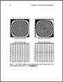
This work is a comprehensive, up-to-date textbook on extracting and using rock and paleomagnetic data in archaeological, geological, and geophysical applications. Designed for students and professionals with knowledge of college level physics and some background in earth sciences, it describes both the theory and the practice of paleomagnetism, covering topics such as the basics of magnetism, geomagnetic fields, how rocks become magnetized, and the various ways of analyzing the magnetism of rocks.
Download or read it online for free here:
Read online
(online html)
Similar books
 Hydro-Geomorphology: Models and Trends
by Dericks P. Shukla - InTech
The field of morphology of the Earth provides a basis for exploring, understanding and comprehending the forms and processes that occur in our surrounding. This book presents some of the ideas around the field of geomorphology ...
(5467 views)
 Engineering Seismology, Geotechnical and Structural Earthquake Engineering
by Sebastiano D'Amico (ed.) - InTech
The book deals with different topics aiming to mitigate geo-hazards: Seismic hazard analysis, Ground investigation for seismic design, assessment and remediation, Earthquake site response analysis and soil-structure interaction analysis.
(9000 views)
 Tectonics
by Damien Closson - InTech
The present book is restricted to the structure and evolution of the terrestrial lithosphere with dominant emphasis on the continents. Topics: Gondwana history, the tectonics of Europe and the Near East; the tectonics of Siberia; and more.
(11813 views)
 Basic Earth Imaging
by Jon F. Claerbout Cecil, Ida Green
The main theme of Basic Earth Imaging is to take a good quality reflection seismic data set from the Gulf of Mexico and guide you through the basic geophysical data processing steps from raw data to the best-quality final image.
(13413 views)