Satellite Positioning: Methods, Models and Applications
by Shuanggen Jin (ed.)
Publisher: InTech 2015
ISBN-13: 9789535117384
Number of pages: 212
Description:
This book is devoted to presenting recent results and development in satellite positioning technique and applications, including GNSS positioning methods, models, atmospheric sounding, and reflectometry as well as their applications in the atmosphere, land, oceans and cryosphere.
Download or read it online for free here:
Download link
(multiple PDF files)
Similar books
 Python Scripting for Spatial Data Processing
by Pete Bunting, Daniel Clewley - Aberystwyth University
This book is a Python tutorial for beginners aiming at teaching spatial data processing. It is used as part of the courses taught in Remote Sensing and GIS at Aberystwyth University, UK. GIS belong the group of applications that process spatial data.
(8702 views)
 Application of Geographic Information Systems
by Bhuiyan Monwar Alam - InTech
This volume presents GIS's applications in different subfields of social sciences. With several case studies conducted in different parts of the world, the book blends together the theories of GIS and their implementations in different conditions.
(13875 views)
 Mapping and the Citizen Sensor
by Giles Foody, et al. - Ubiquity Press
Mapping activities have benefited greatly from recent advances in geoinformation technologies. The proliferation of inexpensive and highly mobile and location aware devices fostered the emergence of the citizen as a source of data.
(5996 views)
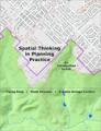 Spatial Thinking in Planning Practice: An Introduction to GIS
by Y. Fang, V. Shandas, E. Arriaga Cordero - Portland State University
This textbook attempts to facilitate spatial thinking focusing more on open-ended planning questions, which require judgment and exploration, while developing the analytical capacity for understanding a variety of local and regional challenges.
(8995 views)