Nature of Geographic Information
by David DiBiase
Publisher: BCcampus 2014
Number of pages: 261
Description:
The purpose of this text is to promote understanding of the Geographic Information Science and Technology enterprise. Nature of Geographic Information is an open geospatial textbook used at Pennsylvania State University and written by David DiBiase.
Download or read it online for free here:
Download link
(multiple formats)
Similar books
 Mapping and the Citizen Sensor
by Giles Foody, et al. - Ubiquity Press
Mapping activities have benefited greatly from recent advances in geoinformation technologies. The proliferation of inexpensive and highly mobile and location aware devices fostered the emergence of the citizen as a source of data.
(5996 views)
 Satellite Positioning: Methods, Models and Applications
by Shuanggen Jin (ed.) - InTech
This book is devoted to recent development in satellite positioning technique and applications, including GNSS positioning methods, models, atmospheric sounding, and reflectometry as well as their applications in the atmosphere, land and oceans.
(7222 views)
 Principles of Geographic Information Systems
by O. Huisman, R.A. de By (ed.) - ITC
A geographic information system is a computer-based system that supports the study of natural and man-made phenomena with an explicit location in space. The GIS allows data entry, data manipulation, and production of interpretable output.
(19077 views)
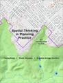 Spatial Thinking in Planning Practice: An Introduction to GIS
by Y. Fang, V. Shandas, E. Arriaga Cordero - Portland State University
This textbook attempts to facilitate spatial thinking focusing more on open-ended planning questions, which require judgment and exploration, while developing the analytical capacity for understanding a variety of local and regional challenges.
(8994 views)